
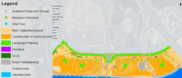
The scope of our services is to provide GIS services to the client in preparing habitat maps and GIS datasets (shape files) required for NOCs from Environmental Agency for approvals. Along-with the analysis we also support our client in procuring high resolution multi-band satellite imagery and produce habitat maps using classification and ground verification methods.
Services Provided: GIS Mapping, Image Processing, Habitat Mapping
Client: Anthesis Middle East
Project Location: Abu Dhabi, United Arab Emirates
Status: Completed (2016)